
Your web browser is no longer supported. To improve your experience update it here
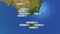
Australian synoptic weather chart
National Synoptic
View national weather
Wednesday 12:05 EST
A low and trough will cross southwest WA, bringing showers, gusty winds & possibly a few storms. A front will cross TAS & clip southern VIC, triggering showers and gusty winds. Onshore winds around a high will drive a few light showers over the north QLD coast.
Issued Tuesday 02:05 EST

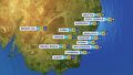
Thursday 12:06 EST
A low and trough over southern WA will cause showers and brisk winds while drawing warmer air over the interior. Onshore winds around a high will drive the odd shower over the north QLD coast. The high will keep elsewhere dry and settled.
Issued Tuesday 02:05 EST

Friday 12:06 EST
A low and trough crossing southeast WA and southwest SA will generate gusty winds, and showers along WA's south coast. Onshore winds feeding a weak trough should lead to a few showers over the north QLD coast. Moist winds around a high should bring showers to VIC.
Issued Tuesday 02:05 EST

Saturday 12:06 EST
A low and trough crossing SA will bring gusty showers and possibly some storms, mainly over SA's west. A front crossing TAS will bring some showers. Onshore winds will drive some showers onto the north QLD coast. Dry elsewhere with high pressure.
Issued Tuesday 02:05 EST

Sunday 12:06 EST
A trough and low over southeast Aus will gain moisture and produce showers and storms over QLD and NSW and showers over VIC and SA. A front will approach WA. Dry elsewhere with a high.
Issued Tuesday 02:05 EST

Monday 12:06 EST
A trough over eastern Aus will gain moisture from onshore winds and produce showers and storms over QLD and NSW and showers over VIC. A front should bring showers and some storms to western WA. Onshore winds may bring some showers to SA's southeast. Dry elsewhere with a high.
Issued Tuesday 02:05 EST
Weather Articles
Data supplied byWeather Zone